I lived in Seabrook, TX, for a little over 10 years, and in all that time I never took the ferry over to the Bolivar Peninsula. Just never had a reason to, I suppose. It's a two-mile ferry ride from Galveston to Port Bolivar, and ...well, it used to be until Hurricane Ike paid a visit. With the ferry service not yet restored, that two-mile trip has become a 100-mile expedition all the way out I-10 east to Winnie, and then south on Hwy 124 to High Island. There's absolutely nothing remotely interesting about this trip...unless you're heavily into swamp land. Once you get to High Island, you then have to traverse the length of the peninsula to get to Port Bolivar...and while I might not be able to say what a trip through hell would look like, it can't be much worse than Bolivar.
While the eye of Hurricane Ike went directly over Kemah and Seabrook and straight up the west side of Galveston Bay, the northeast quadrant of the storm- the "dirty side"- went right over the center of the Bolivar Peninsula. Gilchrist and Crystal Beach were in effect Ground Zero...and the devastation there is unlike anything I've ever seen.
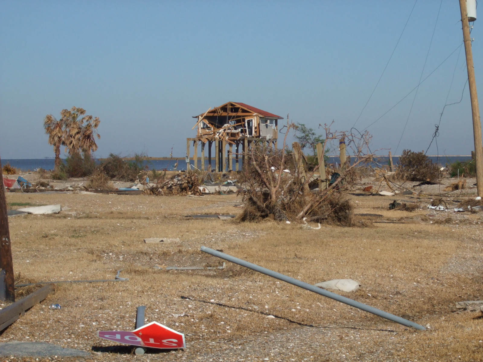
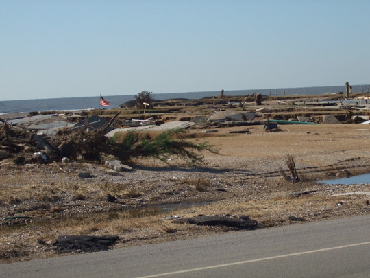
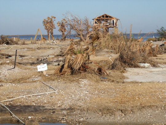
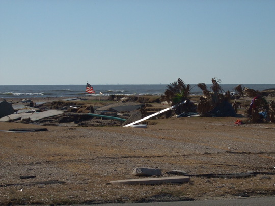
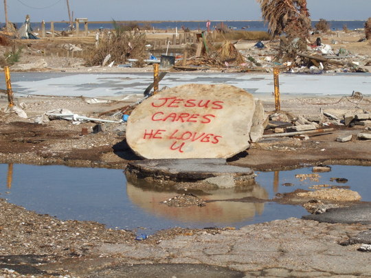
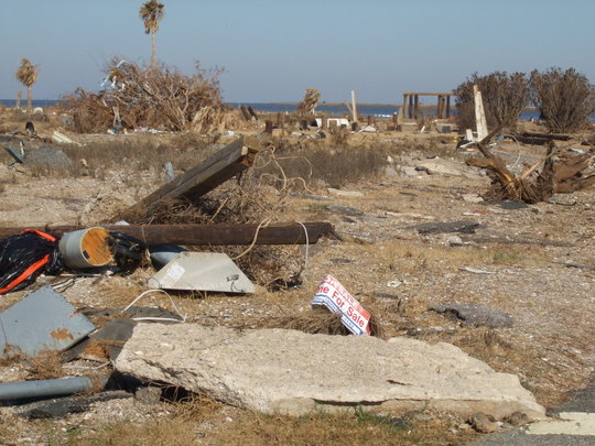
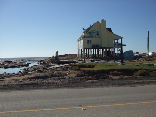
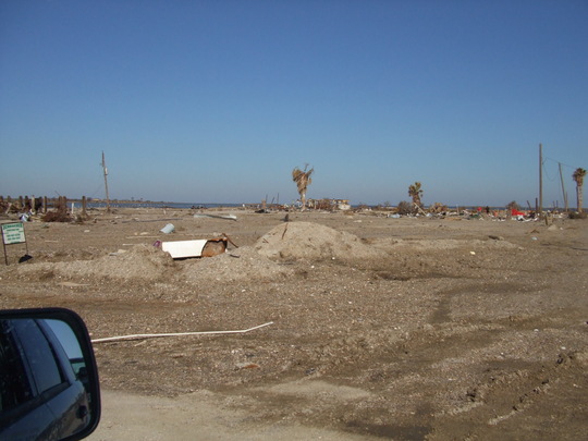
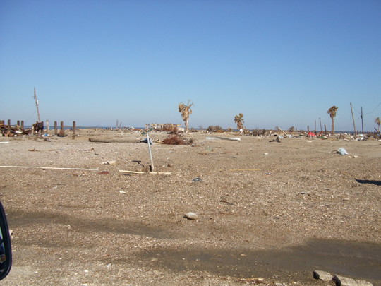
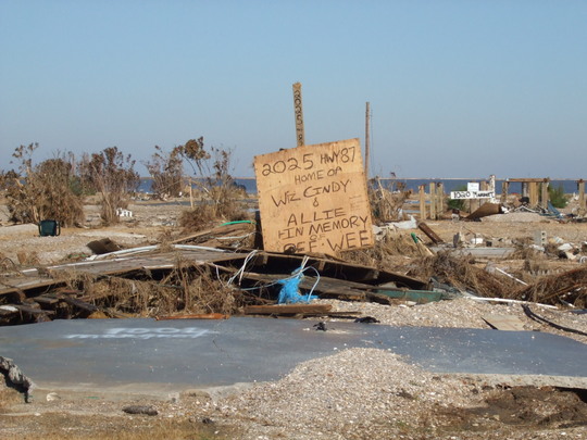
I've seen Croatian villages reduced to rubble by Serbian artillery, but nothing I saw there compared to the complete, utter devastation on the Bolivar Peninsula. Gilchrist is just...gone. Where there used to be a small town, there's now...nothing. Only one house survived anything close to intact. The rest of Gilchrist was obliterated, washed away, and blown north across the peninsula and into Trinity Bay in Chambers County, as if someone or something had cleared it as you would a table. There's simply nothing left of Gilchrist. I couldn't see a single structure in Crystal Beach that wasn't damaged, and the vast majority of homes and businesses suffered catastrophic damage. Driving through Crystal Beach brought me to tears. I just couldn't process what I was seeing, even as much as I've seen of war.
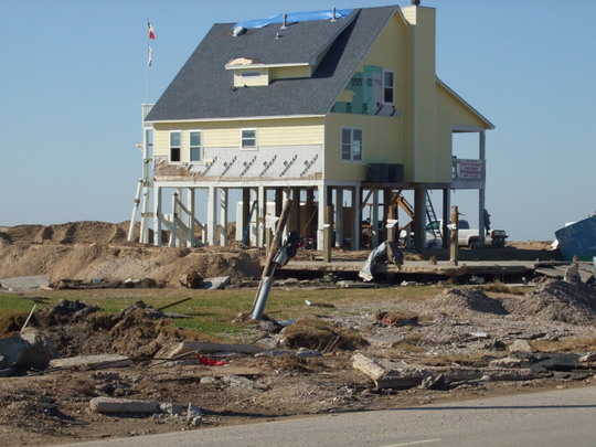
When I was in Croatia, I remember driving through mile after mile of devastation along the front lines. Driving along the Bolivar Peninsula was even worse; mile after mile after mile of complete, total, utter devastation- the sort of damage that no mere words would hope to adequately describe. Port Bolivar survived in better shape than Gilchrist and Crystal Beach, but even there the devastation is difficult to grasp.
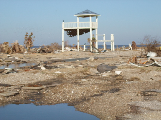
I'd really wanted to take a lot of pictures to document what I was seeing, but once I arrived on the peninsula, I realized that there was simply no way that photographs could accurately capture the totality of the damages I saw. Cars buried in fields, sheds flipped upside down, cars buried in sand drifts, house swept off the slabs and the slabs themselves destroyed, gas stations and businesses completely gutted...I could go on, but I still wouldn't be able to adequately and accurately describe what little is left of the Bolivar Peninsula.
The few pictures that follow will, I hope, give at least some idea of the damage and devastation I saw. Most of them were taken out of the window of my rental car as I drove along Hwy. 87. Some of the photos aren't even that good, but they do give at least some small inkling of the totality of the damage. I hope that I will never see anything like this again.